Tuesday, July 28, 2009

The end of the road


Days: 69
Distance: 5,728 km / 3,559 mi
Location: Stinson Beach, CA

We did it! We biked across America. Yesterday at 12:27 pm Amelia and I jumped into the Pacific Ocean, exactly 69 days 4 hours and 51 minutes after we tagged the water at Revere Beach in Massachusetts.

Here's the stories from California:

Lake Tahoe


We took a day off with Rob, who took us on a fantastic hike up to Lake Dardanelles. Our friend Phil Stevenson and Rob's two dogs also joined us for the hike. Everyone else enjoyed swimming at the lake while I hunted for rocks.


Descent into the Central Valley


We mistakenly believed that descending 7,000 ft into the Central Valley would be easy. However, we quickly discovered that there was quite a lot of uphill involved in going downhill! When we finally reached the valley floor we were relieved by the pancake-flat terrain.


We hopped in the American River Bike Trail in Folsom and followed it over 30 miles to Sacramento. Amazingly, the entire Central Valley from Folsom to Winters is connected by bike trails, so we pretty much never even had to ride on a road.

Sacramento


We stayed with our friend Alex Jordan's family, who live right downtown a few blocks from the capitol building. We wanted to meet Arnold Schwarzenegger, but it turns out the legislature had finally passed the budget the night before and he went home to Hollywood.

Wine Country

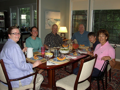
The ride out of the valley and into the North Bay was hilly as expected, but the scenery of California's wine country is gorgeous, with golden rolling hills dotted by vineyards and scrub oaks. We stopped to buy some fresh tomatoes at one of California's many roadside produce stands. Yum yum! Even better food came that evening at my Aunt and Uncle's house in Sonoma. And of course we enjoyed some of the local wine as well.

The ride to the beach


We left my Aunt and Uncle's house at 6 am and coasted down into the Sonoma Valley. The sun was just rising over the hills, and as is always the case in the morning here, the valley was full of fog.


The fog got thicker and thicker! It finally burned off around 10 am.


Beach!


Oh my gosh, the water is cold!

Our welcoming comittee included my Aunt and Uncle, my parents, my brother (visiting from Michigan), and Henry Hallam.


Henry drove all the way up Highway 1 from Santa Cruz in his classic Jetta.


Final thoughts


In some ways our arrival at the beach was bittersweet. While we're excited to have accomplished our goal, it's been an amazing journey, and we're both a little sad that its over. We've seen some amazing places and met so many wonderful people along the way. It's been really interesting experiencing the entire spectrum of culture and geography across North America. Below: Amelia's bicycle odometer, which read 3,559.4 miles at the time of our arrival.


I'd like to sign off this blog by thanking everyone across America and Ontario who helped us along the way by hosting us, feeding us, giving us directions, refilling our water bottles, and cheering us on. We couldn't have done it without you!

Thursday, July 23, 2009

California!


Days: 65
Distance: 5318 km / 3305 mi
Location: South Lake Tahoe, CA

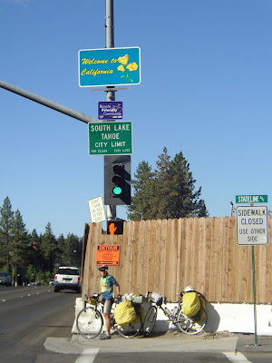
We're in California! It's a little hard to believe, but we are now only a 3-day ride from the beach, and its all downhill. A lot has happened since we last had internet.

The Longest Night

After leaving Provo, we took two days to get to Delta, UT. From there we had to embark on an 83 mile stretch of wilderness in the desert between Hinckley, UT and the Nevada border (where there is a small outpost with a gas station and motel). What's more, this stretch included a 2,000 ft climb. Below: an elevation profile from mapmyride.com of the ride from Delta, UT to the Nevada border.


(click to enlarge)

Since we aren't strong enough to carry enough water for biking a whole day in the desert, we had to switch over to night riding. It's quite cool at night here, often down in the 40s. This allows us to carry less water. However, staying awake and biking for an entire night is not so easy!

We got a motel room in Delta and attempted to go to bed at noon. We managed to get some sleep with a little help from some over the counter sleeping pills. Then, at 9 pm we checked out of the motel and got on our bikes.


The sun was just dipping below the horizon. A blood red sunset stretched out across the sky in front of us. We left Delta, and five miles later passed through Hinckley. At the end of town was a run down gas station and a sign: "Next Services 83 Miles". We passed the sign. The lights from the town faded into the distance behind us as we rode off into the desert.


Biking at nightime here is beautiful. There are so many stars, and you can see the milky way. Above: sunrise over the desert.

We reached the summit of the mountain just before dawn. As we coasted down to the border, the sun came up behind us. We reached the border outpost at 7 am. Ten hours of riding!


Highway 50

Highway 50 is one of only 3 paved highways across Nevada, and it is also dubbed "the lonliest road in America". The highway includes several 70 mile stretches of wilderness and the terrain is extremely mountainous. There are no natural water sources, so unless you can carry enough water to last two days out there you absolutely have to make it from town to town. Below: an elevation profile of highway 50. There are 13 summits between the border outpost and Fallon, NV.
(click to enlarge)

We had to pull several more all-nighters to make it from town to town. In spite of riding all night, sleep proved elusive during the day. My body's internal clock simply refused to switch to a night schedule, and I soon found myself suffering from rather severe sleep deprivation.

Water in the West


This is actually a serious political issue. Cities such as Las Vegas, Phoenix, and Los Angeles use huge amounts of water, and huge sections of the Southern California desert are irrigated to create farmland. The end result is that there simply isn't enough water. As development of desert regions continues, this issue is becoming more and more serious.

Ely, NV

We took a night off in Ely, NV. The town has a cool museum with many relics from the heyday of Nevada's mining industry in the 1800s. Below: an old machine for digging wells.


Amelia in jail for unruly behavior.


An old bicycle. I'm sure glad bicycle technology has improved in the last century!


Other travelers


We have met numerous other cyclists along this desert route. Above: Max, Eric, and Ray, who are cycling from the East Coast to San Francisco. Ray is raising money for a high school music program in Oakland and he has a web page: cyclingbeatjunkie.com

Other cyclists we met include Cyndy and Steve (Sacramento to Rhode Island):

Another guy named Steve, who is biking around the world! ridewithsteve.co.uk

Sand Mountain
so cool!


Fallon, NV


We made it to Fallon, the end of the empty part of Nevada. Fallon is a cool town because it has a naval air base, and you can watch military jets practicing their moves in the sky above. To our delight, we met Carol at a gas station, and she offered to let us stay the night with her family. They even fed us an amazing dinner! Above: Carol, Mike, Patricia, and Amelia.
The Sierras


This is our last mountain range!!! From here we have 7,000 ft to lose to get down to the ocean. We've crossed so many mountain ranges since Colorado I've lost count of them. But now we're done with mountains!

We were warned about the bears...


Lake Tahoe


So now we are in California, our last state. We are couchsurfing with Rob, who has a wonderful place not far from the lake. We're going to take a day off here. Then it's onward to the beach, which is only 230 miles away.

***AN INVITATION***

We will be arriving at Stinson Beach at approximately 11 am on Monday, July 27th! I want to invite everyone reading this who is within traveling distance of Stinson to meet us there for a celebration. Let's call it a potluck: Amelia and I will be bringing a variety of half-finished road snacks. Please feel free to contribute whatever high-calorie foods you want.

The next and final blog entry will be from the coast in about 4 days.

Sunday, July 12, 2009

Into the desert


Days: 54
Distance: 4456 km / 2769 mi
Location: Provo, UT

We're here in Utah, enjoying the beautiful scenery of the high mountain desert. Here's a rundown of the past week:

Steamboat Springs


We couch surfed with Ray, who is an excellent cook! We enjoyed his home baked pizza, and elk that he hunted himself. Ray also showed us some of Steamboat's sights, including fish creek falls (below).


Dinosaur National Monument


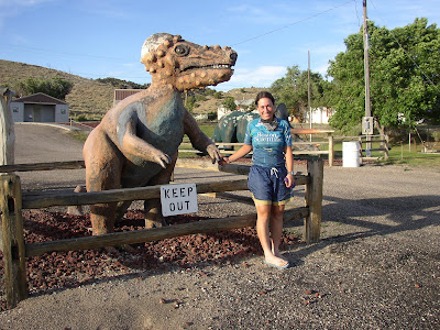
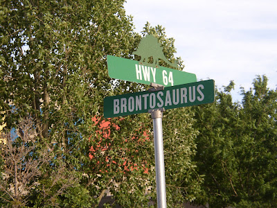
We stopped by the visitor center on the main road. Unfortunately, actually getting to the dinosaur quarry would involve a 32 mile uphill ride, so we decided this is yet another place we'll have to come back to some day. Dinosaur, CO has a fun atmosphere though, with dino statues and themed street names.


Utah

We crossed into Utah at about 4:30 am (our first nighttime crossing of a state line). Since the weather is drier here, we have actually been able to camp tentless. We were excited about sleeping under the stars, but unfortunately so far it has been cloudy every night.


Utah has some pretty awesome geology! We crossed the great basin, where millions of years of sedimentary layers are exposed in roadcuts and canyon walls. The white mineral at the base of this red sandstone is halite (NaCl), otherwise known as salt! I tasted some to make sure.


Utah has some pretty impressive mountains too. The mountains are not going away any time soon. From here we'll be crossing one range after another all the way to the Sierras.


Provo

We're currently couchsurfing with Dan and Robyn. Yesterday afternoon we went inner tubing on the Provo River. This is something I had always wanted to try, so I was really excited!


Unfortunately, it turned out to not be so great. I was completely incapable of controlling where the tube was going, so I spent an hour and a half on the river getting dragged through sharp branches along the sides and bounced over sharp rocks. At one point I even ran over a beaver. I think I'm putting this on my list of things to not do again.

The end of the Mormon Trail

Remember way back in New York when we went through Brigham Young's hometown? Well, we've been following the Mormon Trail ever since then, and now we've reached the end of it. Dan and Robyn showed us around BYU. Here we are hanging out with Joseph Smith.


Action Shots

When we were in Rocky Mountain National Park we met some cyclists along the way. One of them, Steve, was quite skilled at taking photos with one hand while riding and he was kind enough to email me these awesome action shots.


Another of the cyclists, Lonnie, has a pretty cool cycling blog you can check out:
http://www.iowacyclist.crazyguyonabike.com

The desert ahead

We're carefully planning and gearing up for the emptiness of Western Utah and Nevada. This next leg of the trip will be challenging because there are several long stretches between towns. Since biking in the afternoon has proven pretty much impossible with the heat and high winds, we are going to switch over to a fully nocturnal schedule in order to be able to get from one town to the next. This means starting at 9 pm and riding until approximately 9 am the next day.

I might not have internet again until Lake Tahoe, CA. But if I get the chance I will try to send a quick update from some town in Nevada.

Sunday, July 5, 2009

On Top


Days: 46
Distance: 3917 km / 2434 mi
Location: Steamboat Springs, CO

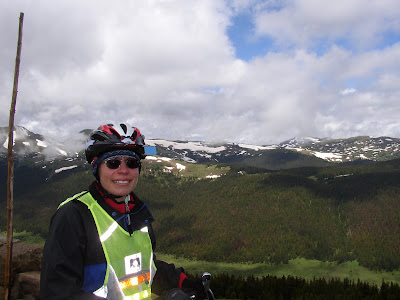
We did it! We crossed the Rocky Mountains. Biking through Rocky Mountain National Park is absolutely the most awesome experience I have ever had in my life!

In fact, it was so awesome that instead of doing this in order I'm going to talk about the mountain first.

An Alpine Start
We left Estes Park (7,300 ft) at about 4:00 am and began the ascent. It's necessary to leave really early because you have to get over the top and back down below treeline before the afternoon thunderstorms roll in. Lightening presents a severe hazard above treeline, especially to people on steel bicycles.


This photo is from Rainbow Curve, which is just over 10,560 feet or in other words two vertical miles above sea level. You hit the treeline about a mile or so beyond the curve. In our case, we also hit a large fog bank at about that time.

On Top


The highest point on the road is at 12,163 ft. Unfortunately there is no sign there anymore because it caused traffic jams when people stopped to take photos with it.

As you can see, the views are spectacular.


Okay, so it wasn't all socked in.


There's lots of snow and ice at the top. The temperature at 12,000 ft was 39 degrees F and it was raining. Brrrr!


Continental Divide - kind of an anticlimax considering we'd already been descending for 1500 ft by the time we reached it.


Once we got down from the mountain, our plans hit a snag. We had planned to camp in a US Forest Service campground at Shadow Mountain Lake, but because it was 4th of July weekend the campground was full. Fortunately for us, Audrey and Irv generously offered to share their campsite with us. They even made us hot dogs! Thank you Audrey and Irv!


Okay, now the other stuff:
Boulder


We stayed in Boulder for three days to visit relatives and friends. I went hiking with my former MIT geology buddies Andy and Mariela, as well as current student Elizabeth and the dog Mia. Mia very much enjoyed this creek.

Estes Park


Highway 36 to Estes Park. I think this photo speaks for itself.

Road to Kremmling, CO


US 34 through a canyon alongside the Colorado River. This ride is mostly downhill for 40 miles. Quite seriously the most fun I've ever had on two wheels!

4th of July


We spent 4th of July in the small town of Kremmling, where we attended a town BBQ and watched fireworks that were launched from the top of a nearby mesa.

Rabbit Ears Pass


What's over the mountain? Another mountain of course! This is the 3rd (and last) time we crossed the Continental Divide.
Most rediculous flat tire ever
Less than a mile outside of Steamboat Springs Amelia's rear tire suddenly pops. Upon inspection we find a small piece of metal imbedded in the tire. So Amelia pulls on it with a pair of pliers and...out comes a two inch long nail!


Amazingly this is only the second flat we've had on the entire trip. Other than that we've had a broken chain and a few broken spokes. The bikes are holding up amazingly well. And so are we :)
Next update will probably be from Provo, UT in about a week. We are looking forward to drier weather in the desert.